The site
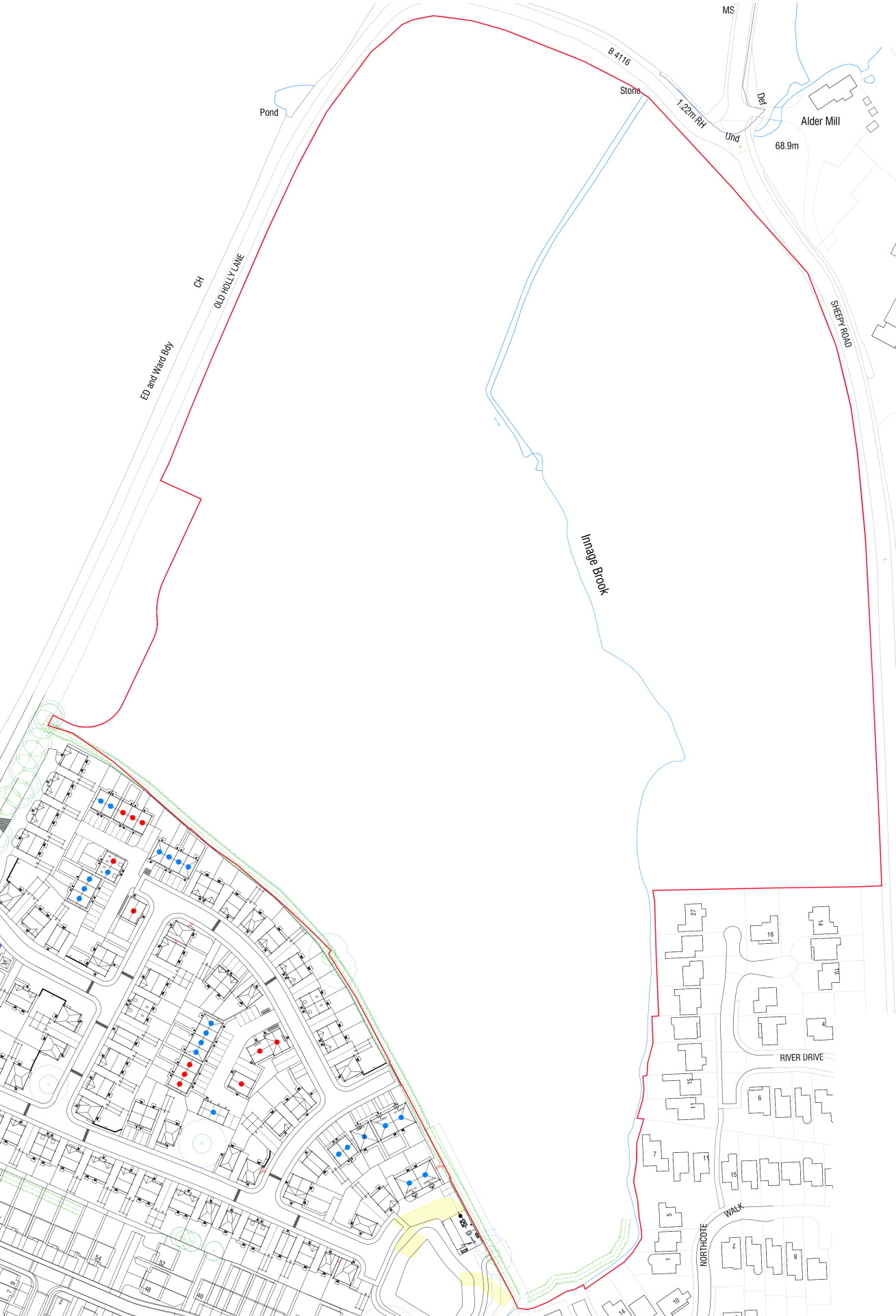
The proposed development site is located to the north of Atherstone, bounded to the west and north by Old Holly Lane and to the east by Sheepy Road. Phase 1 of Bloor Homes’ Atherstone Development, Atherstone Place, lies immediately southwest of the site.
Planning policy context
Why we are proposing these new homes for Atherstone
A Local Plan is a document that sets out the vision for future development in a local authority area. Government requires that all local authorities have an up-to-date local plan in place and review it at least every five years.
Atherstone is one of three market towns in North Warwickshire which are important to the health of the surrounding rural economy as they provide many of the services and facilities to the outlying hinterland.
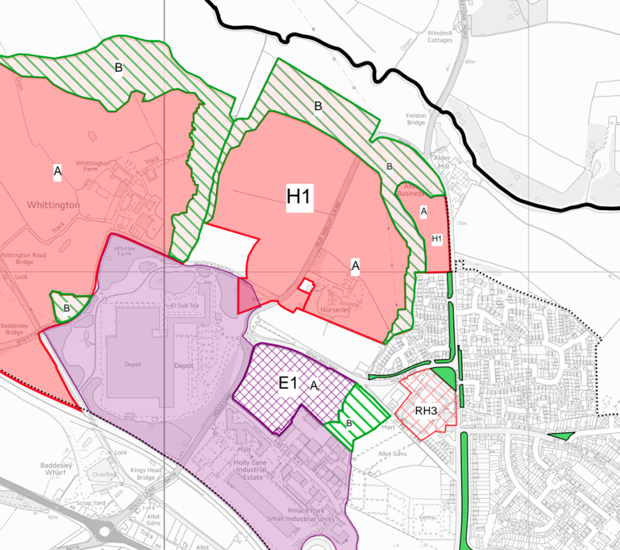
The existing North Warwickshire Local Plan was adopted by the Council in 2021 following extensive consultation. Bloor Homes’ Atherstone development, of which the current plans form Phase 2, is part of a larger allocation for new homes north of Atherstone. This allocation is referred to as Policy H1 in the Local Plan and allocates the area for approximately 620 homes and associated services and infrastructure.
You can find out more about the North Warwickshire Local Plan here: https://www.northwarks.gov.uk/forward-planning/local-plan-north-warwickshire.
Outline planning consent for the wider site to deliver 620 homes and infrastructure was approved in August 2022 following the signing of the S106 agreement. The full planning application for Phase 2 of Bloor Homes’ development is informed by that wider outline planning consent, adding detail to the previously established principles of development.
Extract from the 2021 Local Plan showing the wider allocation site of which Bloor Homes Phase 2 forms part - click to enlarge
Site constraints and opportunities
How local features and landscape have shaped our thinking for the proposed layout of the new neighbourhood.
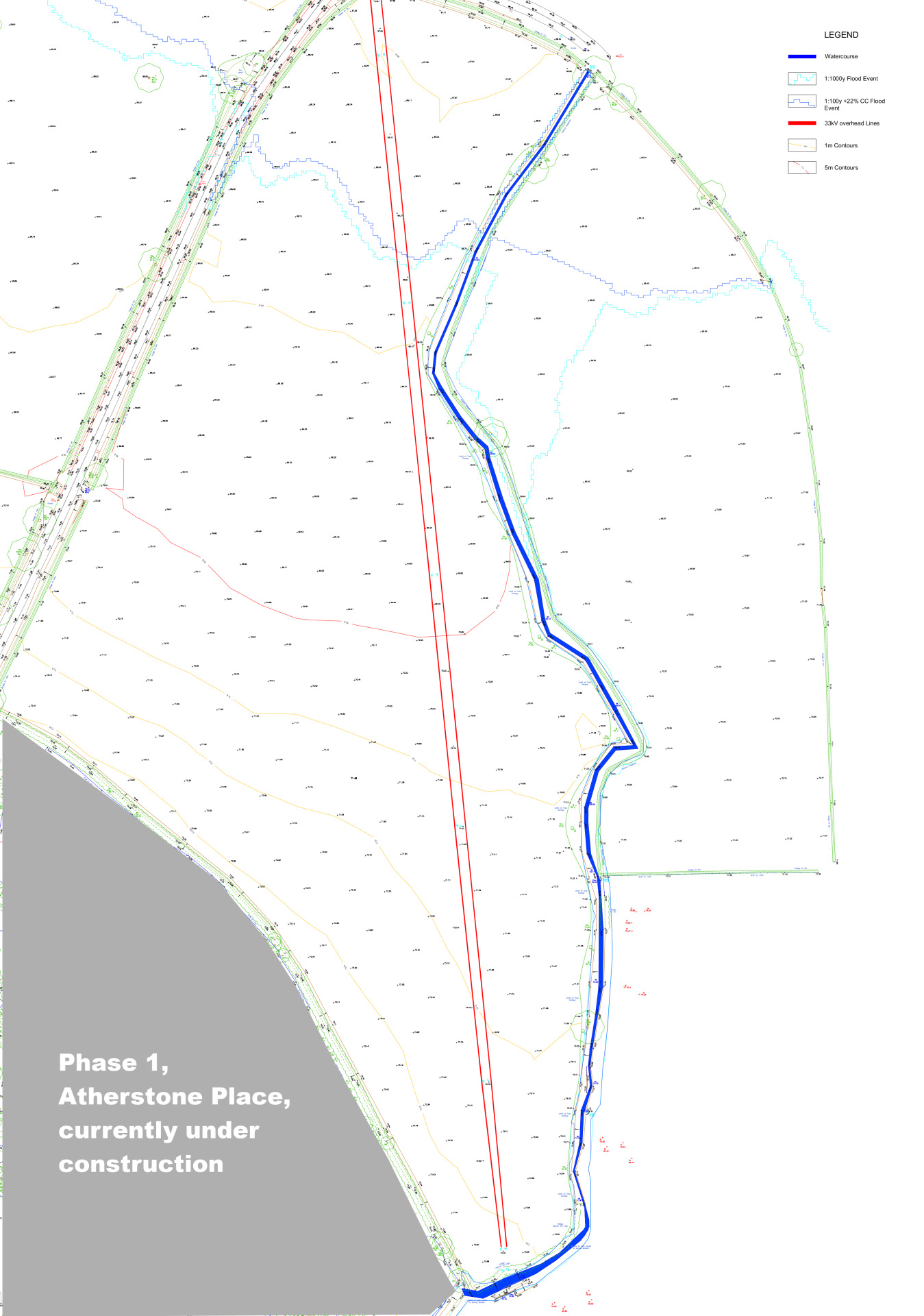
In preparing the layout for the site, the technical team appointed by Bloor Homes first of all considered the landscape features, topography and local context of the area. The following plan shows some of the features and constraints that have informed our plans. Key features include the tree lined Innage Brook and its associated flood areas. The tree-lined brook corridor is being retained and enhanced as an important landscape feature and green corridor. No development is proposed within these flood areas, and a Sustainable Urban Drainage System (SUDS) will attenuate surface water, providing new wetland features providing more varied habitat. The overhead powerlines are to be diverted away from any residential development.
The Phase 2 plans
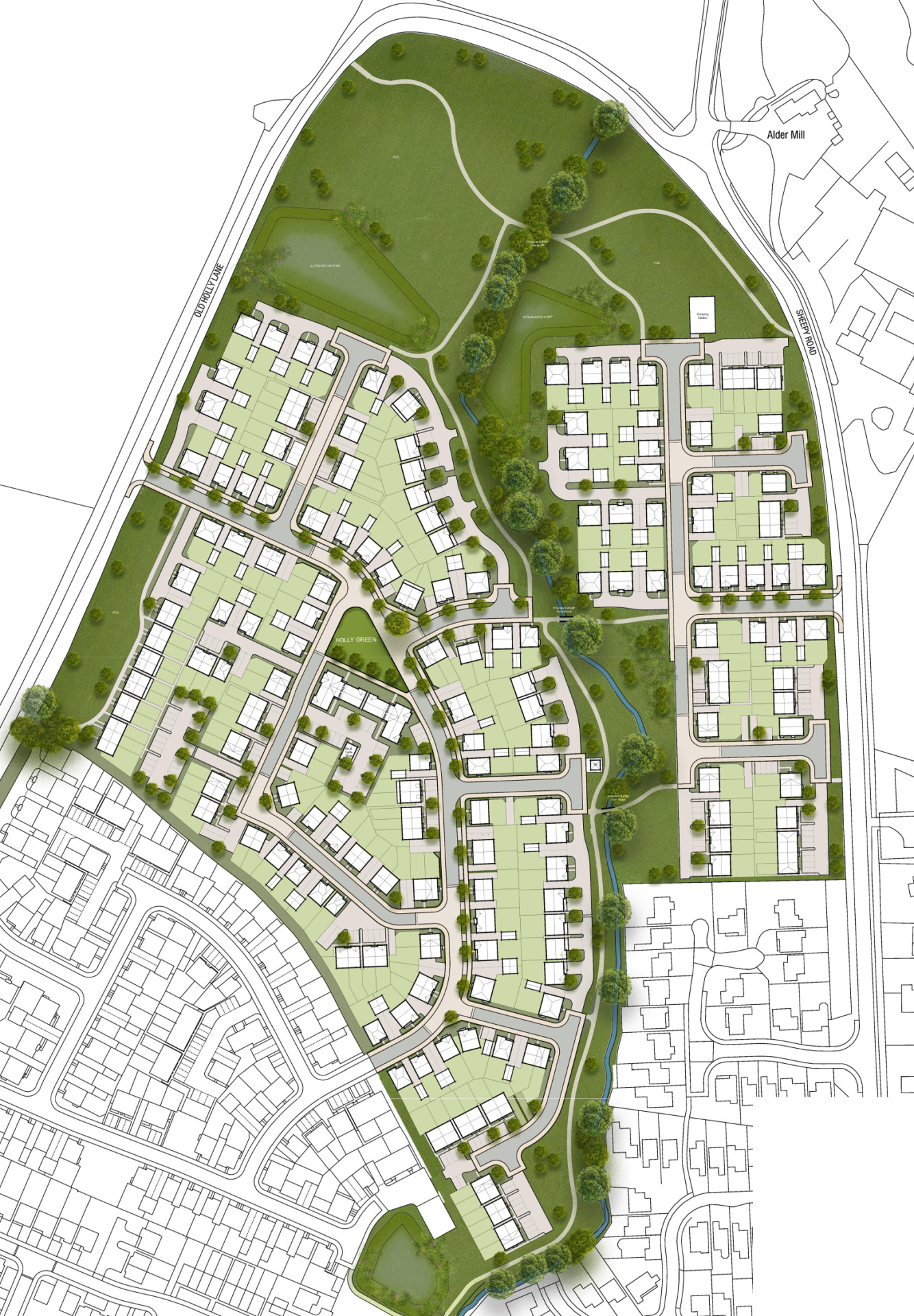
Family-owned housebuilder Bloor Homes is preparing a reserved matters planning application for Phase 2 of the Atherstone development. This will deliver:
- 250 high-quality family homes.
- 40% of new homes would be affordable housing, providing opportunities for key workers and people on low incomes to secure a home of their own in Atherstone.
- The development will be laid out in four distinct character areas or neighbourhoods, creating a sense of place.
- Existing landscape features including perimeter hedgerows and trees framing the Innage Brook corridor through the site will be retained.
- Existing planting and landscape features will be enhanced with additional planting and landscaping, including an extensive area of public open space on the northern part of the site to provide a buffer with the countryside beyond and a green corridor following the Innage Brook to link to further public open space within the new neighbourhood.
- Homes will be built to the very latest standards of sustainability, with measures such as EV charging infrastructure, solar panels, and high levels of energy efficiency.
- Sustainable Urban Drainage will provide new wetland habitat within the site, further enhancing biodiversity.
Character areas and house types
The new homes proposed for Phase 2 ranges from 1 to 5-bed family and affordable homes. These will break down as follows:
- Market homes (60% of overall development – 150 homes)
- Affordable homes (40% of overall development – 100 homes)
The affordable housing provision will be split between affordable rent (80%) and shared ownership (20%) providing an opportunities for those with local connections who are on lower incomes to secure a home of their own in the community.
Character areas
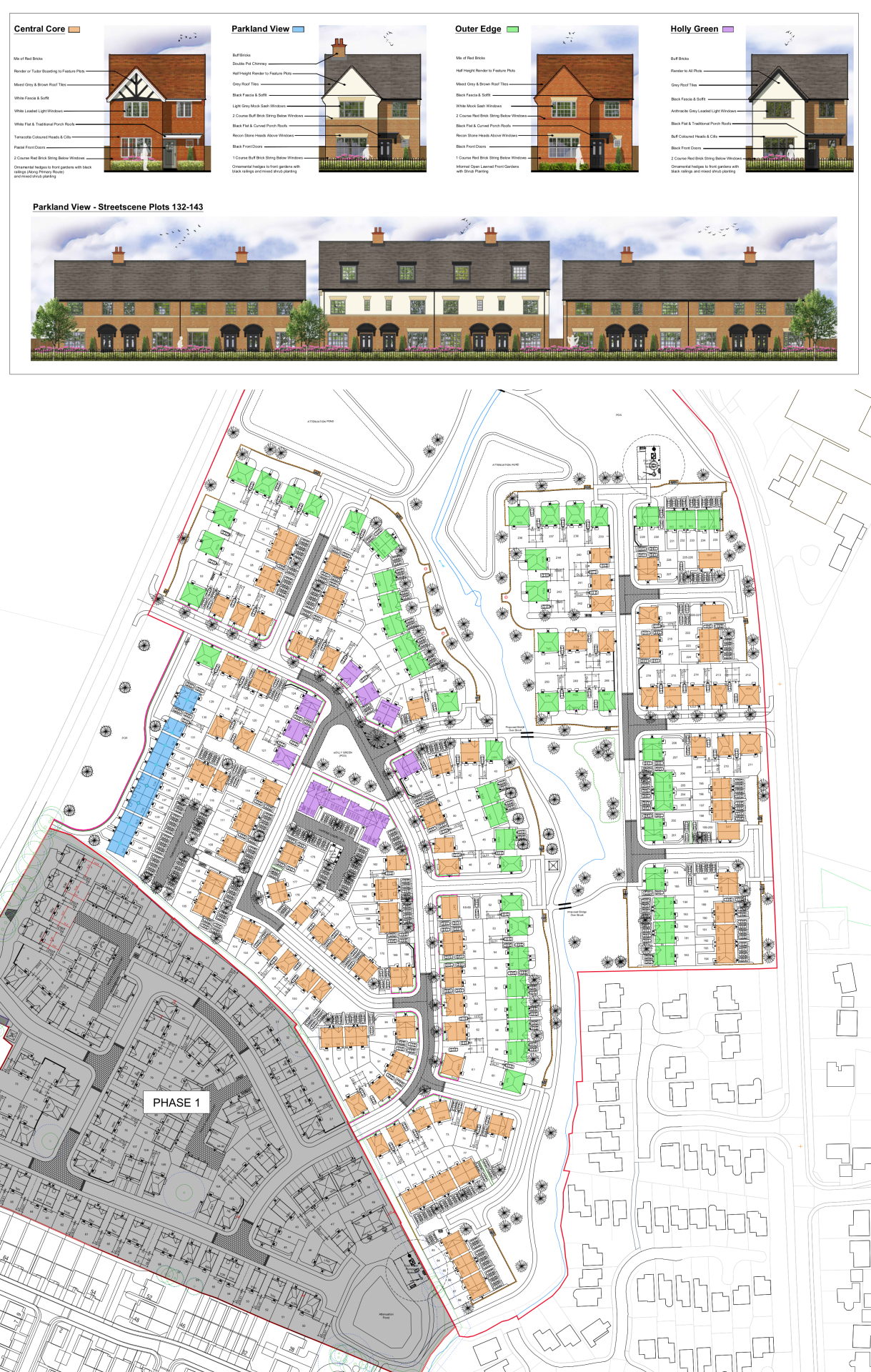
It is proposed that the development will be comprised of four distinct character areas or neighbourhoods, each with its own distinctive design. This will help to create a legible sense of place and create interest within the development. The four character areas are a Central Core of the development, Parkland View which will face west across public open space, Outer Edge which will front the extensive green spaces and landscapes within the development, and Holly Green at the hub of the development.
This plan illustrates the four distinct character areas or neighbourhoods within the development, including an example street scene - click to enlarge
Green infrastructure
We want to ensure that natural habitats are protected while we deliver new homes for people and families.
We are conscious of the ever-increasing importance of that ensuring development is sustainable, protecting and enhancing natural habitats and green infrastructure as much as possible whilst delivering much needed homes for people and families. The planning proposals will be informed by an ecological survey and will seek to enhance biodiversity.
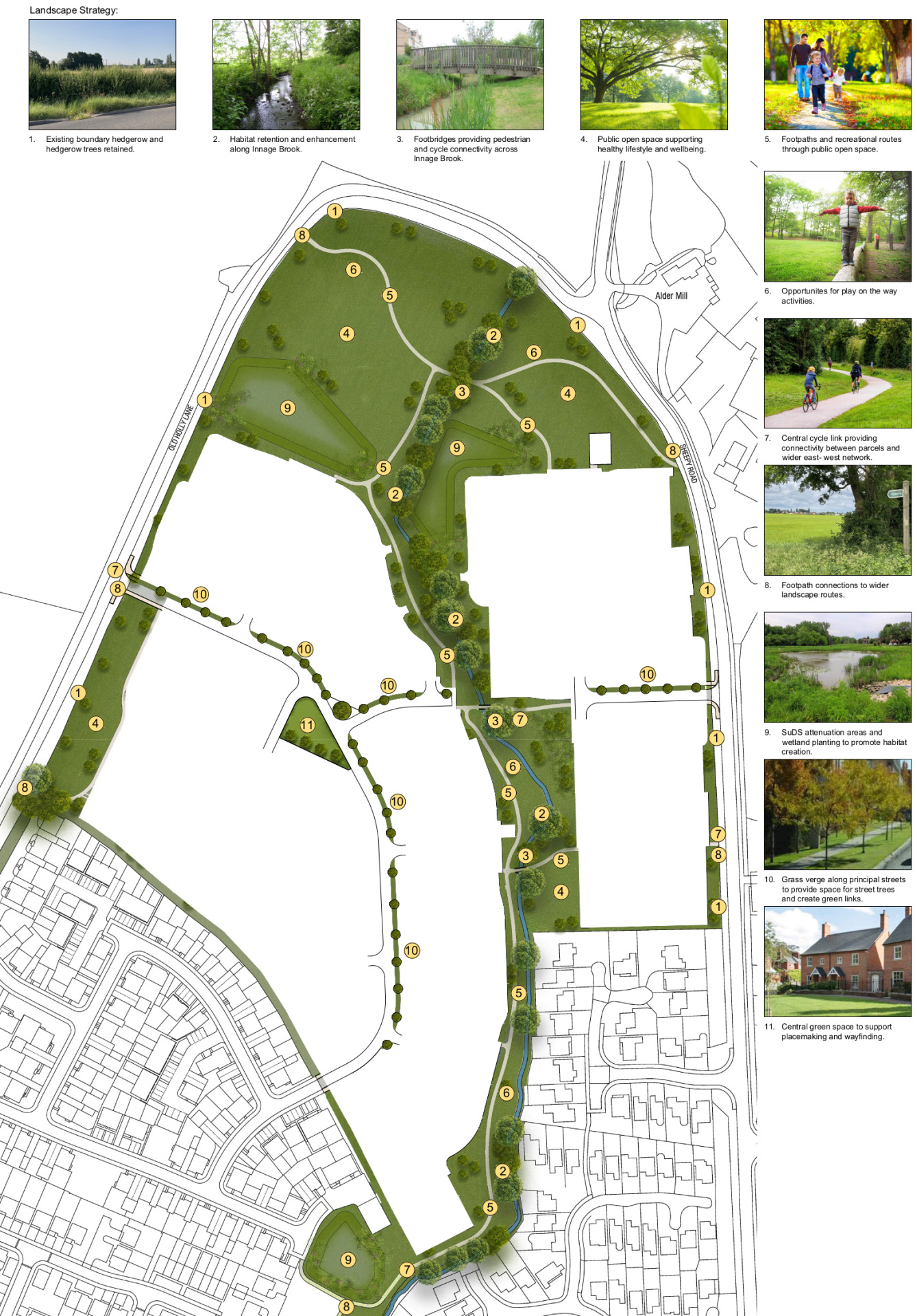
The site is currently largely comprised of improved agricultural land, which is of relatively low value in terms of biodiversity. The new neighbourhood will include the retention of the existing perimeter trees and established hedgerows save for small sections of hedgerow which will require removal to create access. Within the site, the tree-lined corridor of the Innage Brook will be retained and enhanced with additional landscape planting. The north of the site will be set aside as an extensive area of public open space providing a buffer with the open countryside to the north.
Overall, more than 29% of the total site area is being retained as green public open space and habitat areas. This, alongside the planting of new trees and green spaces, and the creation of SUDS features to create new wetland features, will deliver an overall increase in habitat, boosting the biodiversity value of the site.
This plan provides details of the extensive green infrastructure that will form the backbone of development - click to enlarge
Sustainable homes
We want to deliver homes that our sustainable now and contribute to a cleaner, greener future.
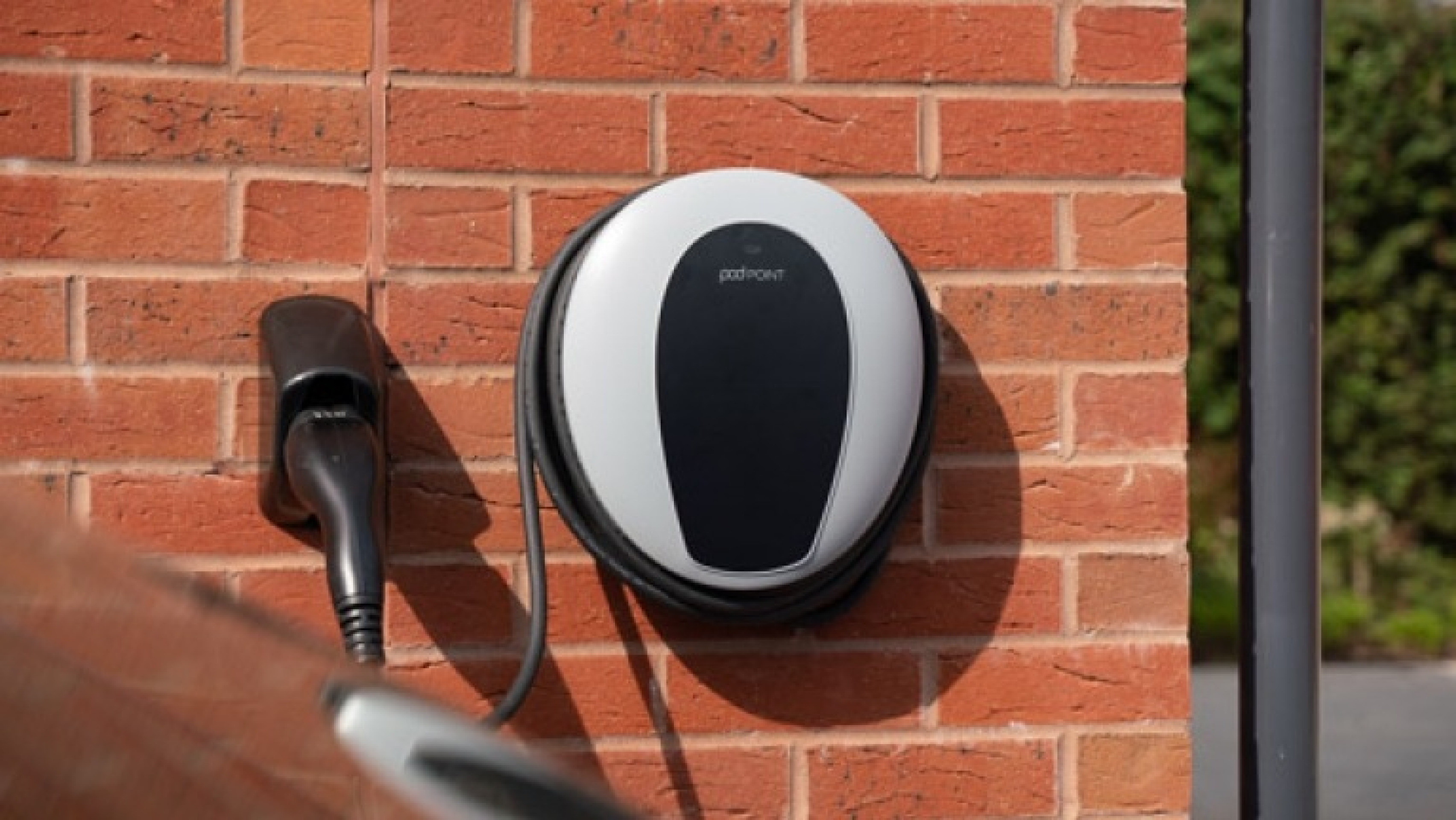
We know that sustainability is hugely important to local people, and we will work to ensure that the new homes we deliver for Atherstone meet the very latest standards in sustainability. With changes to Building Regulations, this will see homes include measures such as EV charging infrastructure, and very high levels of insulation and energy efficiency.
Access and highways
The new development will have vehicular access via a new priority junction from Old Holly Lane to access Phase 2a on the west side of the Innage Brook, while Phase 2b on the east side of the brook will be accessed via a priority junction from Sheepy Road. There will be no vehicular link between the two phases to prevent the creation of a rat-run through the development. There will be a network of walking and cycling routes set within the extensive green open spaces and green corridors through the site, including foot-bridges over the brook to link Phases 2a and 2b.
Flooding and drainage
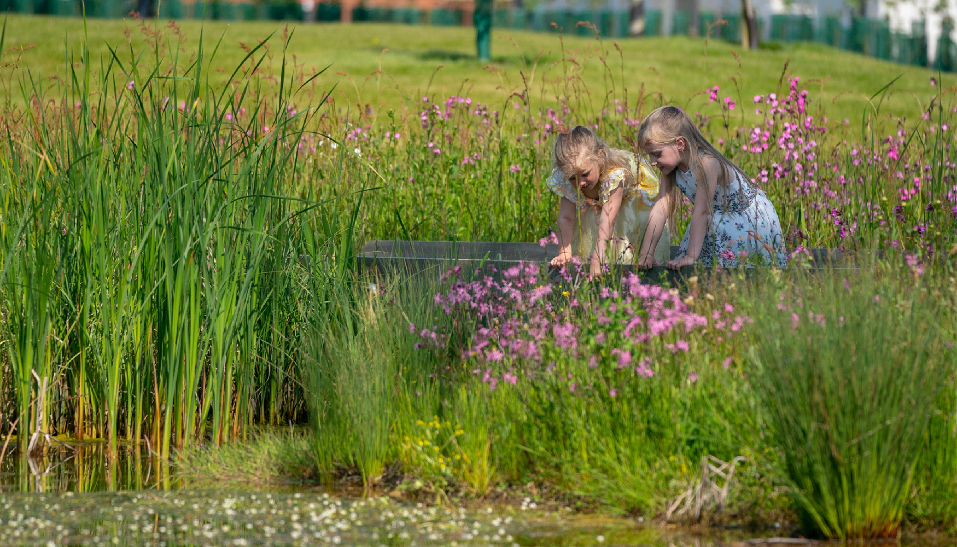
The northern section of the site is location within a flood zone, as is the corridor of the Innage Brook. There is no development proposed within these locations. The provision of SUDS as part of the surface water drainage strategy for the development has the potential to provide an improvement over the current surface drainage situation for the surrounding area, as well delivering biodiversity enhancements through the creation of wetland habitats.
SuDs schemes for the new neighbourhoods will improve surface water drainage locally, whist providing new wetland habitats - click to enlarge
Other technical considerations
The plans for Phase 2 are informed by a suite of technical studies required by the conditions of the existing outline planning consent, including Highways, Flooding and Drainage, Ecology, Contamination etc. These studies confirm that there are no significant technical constraints to delivering a high quality, sustainable residential development at this sustainable location.
Planning application and next steps
Bloor Homes is preparing to submit a full planning application for Phase 2 of their Atherstone Development. The principle of development has already been established via an Outline Planning consent for the wider site granted in August 2022. The full planning application adds detail to these Outline proposals, which in turn were informed by a strategic allocation in the adopted North Warwickshire Local plan.
We would welcome your comments and feedback as we finalise our plans ready for submission to North Warwickshire Borough Council via our short online questionnaire.
Once the planning application is submitted, there will be further opportunity to comment through the Statutory Consultation conducted by the Borough Council as it considers the planning application.
If you would like to be kept updated on progress of the emerging planning application and further consultation opportunities, please ensure you check the box to opt-in for email updates at the end of our online questionnaire or contact form.
